Welcome | Selamat Datang

Malaya Historical Group :: MHG
Aviation and Military Archaeology may cover almost any form of research into or collecting of artifacts connected with the history of aviation and military relics.

If you have any information about any war relics and air wrecks in our country, please send an email to me malayahg@gmail


Home  
WW2 Wrecks    
WW2 Places    
Post War Wrecks    
Photo Gallery    

WW2 Places
Extras  

We found exact spot where the Indian soldiers from 45th Indian Infantry Brigade erected anti-tank obstacles at the bridge near Salak town near Sepang 75th years ago.
   
Selangor Batang Berjuntai
A small town 30km west from Kuala Selangor. A major lockdown battle between Japanese 3rd Battalion 4th Guard Regiment troops who managed to seaborne landed in Sabak Bernam and approached the junction using Tanjung Karang-Kuala Selangor road. The junction were held by 1/14 Punjab and supported by British Battalion 2 miles south at Batang Berjuntai town and the Sungai Selangor bridgehead. Earlier the vital junction was held by Jat/Punjab Regiment but were overrun and later recaptured by supported by 3 companies from British Battalion and 3/17th Dogras.

These junction and the road towards Batu Arang-Rawang was a critical to hold Japanese move to cut British troops held in North Selangor but only a small detachment were send to hold these sectors.


A small isolated junction 2 miles north of Batang Berjuntai town was a vital point of 3/17th Dogras to held Japanese movement from Kuala Selangor.


These junction sector were lost but recaptured back by combination of 3/17th Dogras and British Battalion. The rubber estate where some of the Dogras casualties from snipping where turned into palm trees.

Later in 9th January 1942, after their flanked section were gradually fell back to Rawang and British Battalion had no support on either flanks, and finally lost touch with 15th Indian Brigade at Rawang, they fell back to Batu Arang.

 
British Battalion HQ area commanded by Lt. Col. Morrison in a junction leading to Batang Berjuntai town.   A bridge above Sungai Selangor towards a junction where 3/17th Dogras held their position.

Kuala Kubu
"A Bridge not too far "

A small road junction position connecting road to east via Kuala Kubu town to Gap and Raub with major trunk road from north to Kuala Lumpur. British 9th Indian Division which took heavy fighting and casualties at Kuantan were coming to this section linking up with other retreating units from north.

It must been demolished by British Demolition team to slow down Japanese advance to central Malaya especially to Kuala Lumpur.

What related on this junction below :-

After spending the night in Kuala Lumpur, Percival is joined by Heath for the drive 100 miles (160 km) north to Tapah, now the HQ of the Indian 11th Division. Enroute the two generals stop at the vital Kuala Kubu road junction and later inspect its ``last ditch" defence preparations north of Tanjong Malim. They then drive on to Slim River for discussions with Col Stewart, commander of the Indian 12th Brigade. All three agree that if the Japanese are to be prevented from over-running the central Malayan airstrips before the expected allied reinforcement convoy arrives in mid-January, the Kuala Kubu road junction must be held along with the key east-west road

By the time Japanese seaborne landing in west Perak coast in 2nd January, British Commander agreed that many troops will be encircle and trapped if Japanese managed to arrive in Rawang town 10 miles south of this junction. So on January 8, British troops were ordered to withdrawal to new position south of Negeri Sembilan thus leaving Kuala Lumpur as open city with 2 airfield will be captured easily leaving a Gurkhas detachment as a rearguard at Serendah town 5 miles north of Rawang. 

On January 10, after a bitter fighting with Gurkhas at Serendah, Japanese managed to hold its ground and proceed to Kuala Lumpur. By January 11, most of British troops were leaving and the last bridge near Kuala Lumpur was blown at 4.30am.

The demolished bridge was abandoned and after war the new bridge was built on top of the destroyed bridge.


Remains of the bridge submerged under water
 
Broken structures bares the destruction using high explosive
     

Well hidden from road users
 
The bridge which now below the electric lines
     

Operation Zipper

Operation Zipper is to be launched from Ceylon (Sri Lanka) and various parts of India, was planned for September 1945.  It was too far advanced to be cancelled and went ahead as an exercise but without naval or aerial bombardments.  It entailed landings on the West Coast of the Malay Peninsula north of Port Dickson and south of Port Swettenham (now Klang).  General Robert’s XXX1V Indian Corps (5th, 23rd, 25th and 26th Indian Divisions, 3rd Commando Brigade and one Parachute Brigade of the British 6th Airborne Division, comprised a force of more than 100,000 men.

These men were expect to get some warm reception from the Japanese Army who were stationed up in Kuala Lumpur. At that time of the Zipper landing, there were 6,000 Japanese troops stationed in Kuala Lumpur but they did not give any threat to the landing forces.

Three different landing zones were selected. 25th Division will landed on Morib Beach, 37th Brigade will get to the Bagan Lalang Beach, 10 miles south Morib and 23rd Division will scattered on Port Dickson beach.

The Zipper convoy had sailed from Bombay, Madras, Calcutta and Rangoon, and were converging on the Malayan coast at Port Swettenham. Escorted by HMS Nelson, flying the flag of Admiral Walker, and Richelieu, the cruisers Nigeria, Cleopatra and Ceylon, the 21st Aircraft Carrier Squadron of Royalist ( Commodore Oliver ) and the escort carriers Hunters, Stalkers, Archer, Khedive, Emperor and Pursuer and fifteen destroyers, the first D-Day assault convoys arrived off their beaches at first light on 9 September.
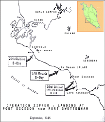

Operation Zipper : Map of the Operation

Port Swettenham and Klang were occupied on the first day, Kelanang airfield was handed over by the Japanese. Port Dickson was occupied the next day. On 12 September a new beach was opened farther south at Cape Rachado, where the 23rd Division landed without any of the difficulties met at Morib.

By the time the beaches were closed, Morib on 25th, and Cape Rachado on 28th September, 63,838 troops, 7,337 vehicles and 25, 671 tons of stores had been landed over them.

British troops entered Kuala Lumpur without resistance on 13 September.

However, post war assessment showed that the Japanese had only 130,000 troops in the whole Malaya, and the Zipper with a quarter of a million men and full fire support from air and sea would certainly have succeded.
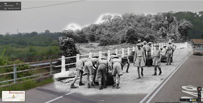
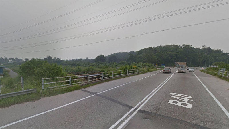
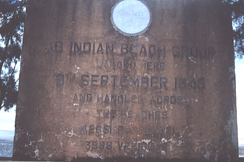
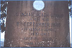
On the beaches right now, nothing were left except for the memorial stones erected by the landing forces to commemorate their historic landing 60 years ago. On the stones erected by 46th Indian Beach Group in 9th September 1945.

Not so many people knew about this significant landing occurred on this beaches. Perhaps this beaches served them as the most popular picnic and swimming spot for weekenders. 
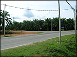
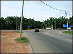
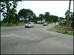
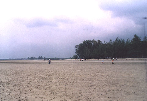
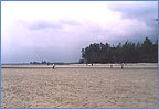
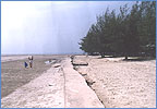
Panoramic view at Bagan Lalang Beach
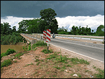
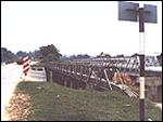
New seawall construction to prevent sea erosion
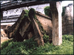
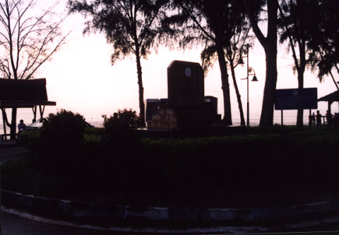
Memorial Stone at Morib Beach
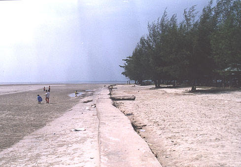
 The stone was laid on the popular spot at Morib Beach


Copyright © 2017 MHG